
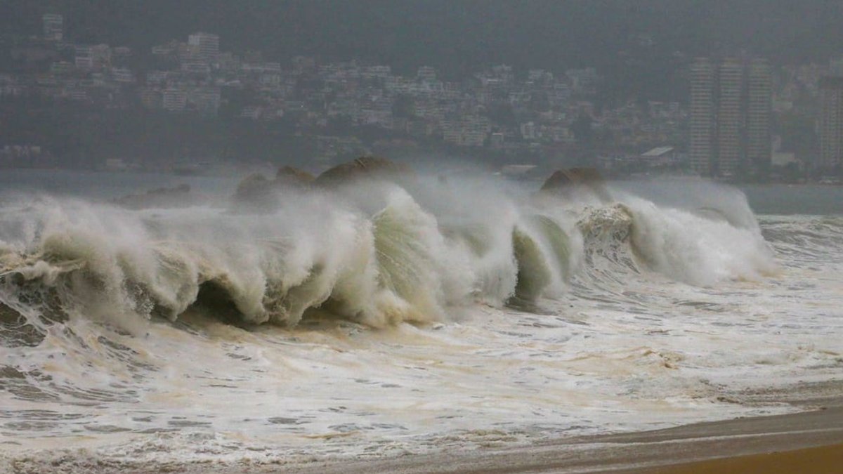
Hurricane Polo intensified to a Category 4 storm on Monday, September 21, threatening to become one of the year’s most powerful cyclones. The National Hurricane Center confirmed its rapid strengthening off Mexico’s Pacific coast. By 9:00 a.m. local time, the storm’s center was approximately 320 km southwest of Zihuatanejo, Guerrero, and 410 km south-southeast of Manzanillo, Colima, with sustained winds of 85 km/h and gusts up to 105 km/h, moving northeast at 7 km/h.
At 9:00 p.m., Polo was 310 km southwest of Zihuatanejo, Guerrero, and 495 km south-southeast of Manzanillo, Colima, with maximum winds of 175 km/h and gusts up to 215 km/h. It moved south-southeast at 7 km/h. The storm generated intense rainfall across multiple states, including 75 to 150 mm in Oaxaca’s coast and southern regions, 50 to 75 mm in Michoacán and Guerrero’s coastal and southern areas, and 25 to 50 mm in eastern and southern Jalisco and Colima. Coastal areas in Colima, Michoacán, Guerrero, and Oaxaca experienced winds of 10 to 20 km/h with gusts up to 50 km/h, alongside 2 to 3-meter waves in Guerrero and Michoacán.
Where is Hurricane Polo now?
By midnight on Tuesday, September 22, Polo had reached Category 4, positioned 340 km south of Zihuatanejo and 530 km south-southeast of Manzanillo. Mexico’s National Water Commission (Conagua) reported heavy rainfall in Guerrero, Oaxaca, Michoacán, Jalisco, and Colima. The storm’s rapid escalation from a tropical depression to a Category 4 hurricane within five hours surprised meteorologists, who initially predicted it would peak at Category 3.
Read Also: Women face deeper financial struggles than pay gaps alone
Initially forecast to peak at Category 3, Polo defied expectations, escalating to Category 4 within hours. Conagua and civil protection officials emphasized Tuesday as critical for assessing risks and deploying safety measures, with a focus on protecting vulnerable populations and infrastructure.
The storm’s projected path includes:
- September 21, 2:00 a.m.: Tropical storm 340 km southwest of Zihuatanejo.
- September 21, 10:00 a.m.: Category 1 hurricane, 285 km south-southwest of Zihuatanejo.
- September 22, 12:00 p.m.: Category 4, 295 km south-southwest of Tecpan de Galeana.
- September 23, 12:00 a.m.: Category 5, 260 km south-southwest of Zihuatanejo.
- September 24, 12:00 a.m.: Category 5, 60 km south-southwest of Punta San Telmo, its closest point to the coast.
- September 25, 12:00 p.m.: Category 4, 365 km west-southwest of Cabo Corrientes, Jalisco.
Conagua warns of potential landslides, river flooding, and coastal inundation, urging residents to monitor updates from the National Meteorological Service. The agency has established a watch zone from Tecpan de Galeana, Guerrero, to Punta San Telmo, Michoacán, covering areas at high risk of severe weather impacts.
Read Also: Macondo Park opens in Madrid for Shakira residency
Which states will be most affected?
The hardest-hit states are expected to be Jalisco, Colima, Michoacán, and Guerrero, with Oaxaca experiencing heavy rain early on.
Currently, Polo is not projected to make landfall. However, its proximity will disrupt air travel, with Mexico City’s international airport advising passengers to check for flight changes to affected regions. Travelers to Michoacán, Guerrero, Jalisco, and Colima are urged to stay informed about potential flight delays or cancellations.
In Guerrero, authorities have suspended classes in Costa Grande, Costa Chica, and Acapulco for Tuesday, September 22, prioritizing student safety. The state government emphasized the importance of safeguarding the educational community from potential hazards. Conagua has issued a watch zone from Tecpan de Galeana to Punta San Telmo, covering areas at risk of severe weather impacts, including landslides, river flooding, and coastal inundation.
Read Also: Pan’s Labyrinth returns to Mexican theaters in restored 4K
Potential Impacts and Preparations
Conagua has issued a watch zone from Tecpan de Galeana, Guerrero, to Punta San Telmo, Michoacán. This area is at risk of severe weather impacts, including landslides, river flooding, and coastal inundation. Residents are advised to take precautions, such as securing loose objects, stocking up on supplies, and following evacuation orders if necessary.
Storm’s Projected Path and Intensity
According to Conagua, Hurricane Polo is expected to continue intensifying. By September 23, it is projected to reach Category 5 status, located 260 km south-southwest of Zihuatanejo, Guerrero. On September 24, it will be at its closest point to the coast, 60 km south-southwest of Punta San Telmo, Michoacán, still as a Category 5 hurricane. The storm’s proximity to the coast will bring heavy rainfall, strong winds, and rough seas to the affected regions, even without making landfall.
The storm is then forecast to weaken slightly to Category 4 by September 25, positioned 365 km west-southwest of Cabo Corrientes, Jalisco. While Polo is not expected to make landfall, its impact on coastal areas will be significant, with intense rainfall, high winds, and dangerous sea conditions persisting through the end of the week. Mexico City’s international airport has advised passengers traveling to Michoacán, Guerrero, Jalisco, and Colima to check for flight changes due to the storm. The most severe conditions are anticipated from Wednesday, September 23, through Friday, September 25, with intense rainfall and winds expected in the hardest-hit states.


Leave a Reply